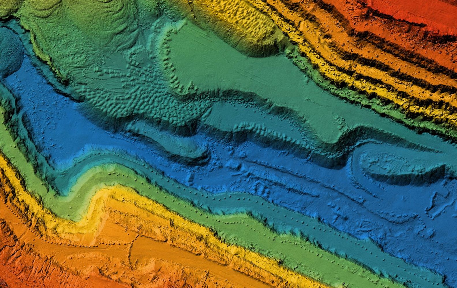
Bachelor of Geospatial Science
Dive deep into data. Make it meaningful. Then get creative to solve some of the complex problems facing the environment and help to make people’s everyday lives a little easier.
Duration
36 months
Starting Date
February, July
Tuition Fee
AUD $32,560 per year
Location
Online
CRICOS
00005F
About the program
As a geospatial scientist you’ll study the relationships between physical locations, people, and earth processes. And you’ll develop the skills and understanding to make connections between people, places and processes.
Begin the online Bachelor of Geospatial Science at Charles Sturt University with a solid foundation in geographic information science, remote sensing and cartography. Then build your own unique knowledge platform by specialising in information science, mathematics, ecology, geography, agriculture or emergency management.
Designed in consultation with experts to maximise industry relevance, this course gives you plenty of hands-on experience right from the start. You’ll be solving geospatial problems and diving into work placements from your first year of study.
While many geospatial science undergraduate degrees concentrate on professional surveying practice, the Bachelor of Geospatial Science takes a fresh approach. This course offers you a unique opportunity to focus on geographic information systems (GIS) and remote sensing in a dedicated degree.
Career opportunities
- Geospatial science is a rapidly growing field whose graduates are in high demand around the globe. The career opportunities are excitingly diverse and span government and industry sectors.
- What does a geospatial scientist do? How about contribute to a sustainable world through environmental and agricultural analysis and management (including water and land resource management) with local, state or federal government, for catchment management authorities or consultancies.
- Shape the future in business analysis and planning including urban planning, census analysis, resource planning and utilities management for government and the corporate sector.
- Support communities through disaster and emergency management, or with the analysis of areas such as health and disease, crime patterns or human migration.
Courses Included
- Principles of Geographic Information Systems
- Remote Sensing of the Environment
- GIS Applications
- Remote Sensing: Image Processing and Analysis
- Remote Sensing : Information Extraction
- Cartography
- Programming in GIS and Remote Sensing
- Earth System Processes
- Scientific Statistics
Interested? Get started today!
Other interesting programs
-
-

Master of Clinical Exercise Physiology
- Play a critical role enhancing the health of the nation with the Master of Clinical Exercise Physiology from Charles Sturt…
Play a critical role enhancing the health of the nation with the Master of Clinical Exercise Physiology from Charles Sturt University.
-
-
-

Postgraduate Diploma of Psychology
- Set your psychology career in motion. The Psychology program from Charles Sturt University is an accredited course that satisfies the…
Set your psychology career in motion. The Psychology program from Charles Sturt University is an accredited course that satisfies the current minimum academic requirements for provisional registration as a psychologist. As a fourth year of training in psychology, this psychology course is designed to suit those intending to pursue a career in psychology.
-
-
-

Master of Theology
- The Master of Theology from Charles Sturt University offers depth and breadth in theological education. This course builds on your…
The Master of Theology from Charles Sturt University offers depth and breadth in theological education. This course builds on your previous theological study to help you develop an in-depth understanding of major issues in contemporary theology. It provides advanced critical knowledge and skills in the theological disciplines and their application to contemporary society and church.
-
-
-

Master of Teaching (Secondary)
- You’ll be ready to change lives as a high school teacher with the graduate-entry Teaching (Secondary) program from Charles Sturt…
You’ll be ready to change lives as a high school teacher with the graduate-entry Teaching (Secondary) program from Charles Sturt University. Our online master’s degree qualifies you to teach one or more subjects to secondary students and support their social, emotional, intellectual and physical development.
-
-
-

Master of Teaching (Primary)
- Study online and cultivate a love of learning as a dynamic primary school teacher. A Teaching (Primary) program with Charles…
Study online and cultivate a love of learning as a dynamic primary school teacher. A Teaching (Primary) program with Charles Sturt University is a graduate-entry online degree that prepares you to teach children aged from five to 12, helping them develop the knowledge, skills and dispositions to provide the best possible start in life.
-
-
-

Master of Speech Pathology
- Steer your career in a new direction with the accredited Master of Speech Pathology from Charles Sturt University.
Steer your career in a new direction with the accredited Master of Speech Pathology from Charles Sturt University.
-
-
-

Master of Social Work (Professional Qualifying)
- Turn your passion for pursuing social justice and human rights into your future career. The Social Work (Professional Qualifying) program…
Turn your passion for pursuing social justice and human rights into your future career. The Social Work (Professional Qualifying) program from Charles Sturt University prepares you to make a meaningful contribution to people and communities as a dynamic professional social worker.
-
-
-

Master of Social and Organisational Leadership (with specialisations)
- The Master of Social and Organisational Leadership (with specialisations) from Charles Sturt University is about developing tomorrow’s leaders, today. You’ll…
The Master of Social and Organisational Leadership (with specialisations) from Charles Sturt University is about developing tomorrow’s leaders, today. You’ll be equipped to become a successful, inspirational and ethical leader.
-
-
-

Master of Project Management
- Become a business leader with the skills to successfully manage complex projects. Designed for professionals from diverse backgrounds, the Master…
Become a business leader with the skills to successfully manage complex projects. Designed for professionals from diverse backgrounds, the Master of Project Management from Charles Sturt University provides preparation for a range of project management certifications, such as those offered through the Project Management Institute.
-
-
-

Master of Professional Information Technology (with specialisations) – Software Development specialisation
- The Master of Professional Information Technology (with specialisations) - Software Development specialisation from Charles Sturt University will put you at…
The Master of Professional Information Technology (with specialisations) - Software Development specialisation from Charles Sturt University will put you at the cutting edge of the IT industry – where employers need you to be.
-
-
-

Master of Professional Information Technology (with specialisations) – Networking specialisation
- The Master of Professional Information Technology (with specialisations) - Networking specialisation from Charles Sturt University will put you at the…
The Master of Professional Information Technology (with specialisations) - Networking specialisation from Charles Sturt University will put you at the cutting edge of the IT industry – where employers need you to be.
-
-
-

Master of Professional Information Technology (with specialisations) – Data Science specialisation
- The Master of Professional Information Technology (with specialisations) - Data Science specialisation from Charles Sturt University will put you at…
The Master of Professional Information Technology (with specialisations) - Data Science specialisation from Charles Sturt University will put you at the cutting edge of the IT industry – where employers need you to be.
-